Cochise Stronghold
East and West
Stronghold East Campground and Cochise Trail #279
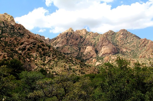
Cochise Stronghold East
Cochise Stronghold East provides a vast range of activities to suit most anyone! Hiking and Equestrian trails, rock-climbing, birding and camping!
This lovely area has a campground that accommodates RV's up to 30' in length. There are a total of eleven sites. Nine for tents or RV's and 2 group sites. Each site has a grill and picnic table on a cement pad. There are handicap accessible restrooms. This is a fee area with a maximum stay of 14 days.
There is an interpretive nature trail, as well as the Trail-head for Cochise Indian Trail #279. This Trail will take you over the mountains to the West Stronghold. There are benches strategically located to take in the views and relax.
Please take the time to refer to the 'Leave No Trace' information.
For the birders' among us, please check out this site, the 'Cochise Stronghold Bird List,' for more information:
For rock-climbing information, please check out this site, 'Mountain Project Climbing Cochise Stronghold'
US Forest service site, Cochise Stronghold Campground info:
COCHISE INDIAN TRAIL #279:
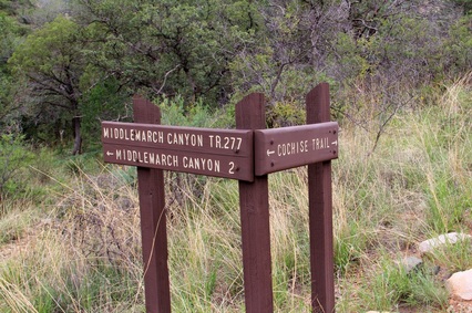
Turn for MIDDLEMARCH CANYON TRAIL
Cochise Indian Trail #279
The trail is about 5 miles in distance; with an approximate elevation gain of 1,100' with a few switchbacks at the steepest part of the trail. If you don't want to hike over and back; leave a car at the opposite trail-head or have someone pick you up!
The West trail-head will require 4 wheel-drive. Directions to the trail-head are below, under GETTING THERE.
When starting the hike at the East trail-head, after about one mile, is the Cochise Springs. Travel an additional mile and you come to Half Moon Tank, which is a small concrete dam. A mile further on, or about three miles from the trail-head is the Stronghold Divide. (you're over half-way at this point!)
The trail is marked quite well with mile markers, etc. Scenery along the trail is the Stronghold at its best....with lots of plant and animal life and unique rock formations. Average hike time is approximately four hours. This will vary greatly depending on how much time spent off-trail, taking pictures, etc. This goes without saying, with the Arizona sun, PACK PLENTY OF WATER! Dogs are welcome here when leashed.
GETTING THERE:
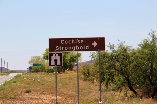
Stronghold East and trail-head
Off I 10 at exit 331. Take State Route 191 south about 18 miles to Ironwood Road. Right on Ironwood (Ironwood becomes Forest 84) and goes all the way to the campground. (Fee Area).
West Trail-head
Take Middlemarch Road off Rt. 80 near Tombstone, (between mile markers 314 and 315). After 10.2 miles on Middlemarch turn left onto Forest Road 687. I've not seen a sign for this road so here are the GPS coordinates. N 31 50.813 W 110 0.191
Follow Forest 687 for 10 miles, it ends with parking for the trail-head.
WHAT YOU'LL SEE:
***********************************************************************************************************************
Cochise Stronghold West
Council Rocks
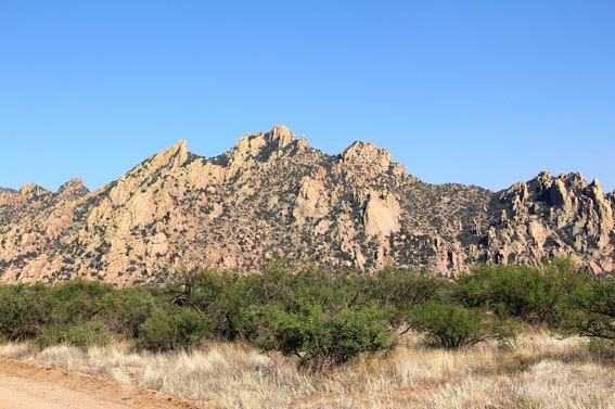
Looking east, at Cochise Stronghold
THE COCHISE STRONGHOLD
The Cochise Stronghold in the Dragoon Mountains was once the refuge of the great Chiricahua Apache Chief, Cochise. This rugged area was home for 250 warriors and up to a total of 1000 in the tribe for up to 15 years. Being able to observe the valley below form the towering spires of rock, they could spot their enemies and attack!
Cochise, a master strategist and leader, was never conquered in battle. For a decade Cochise and his band of warriors tormented the mining camps, passing stagecoaches and peaceful ranchers in the area. After Cochise made peace with General O. O. Howard, he resided on the Chiricahua Reservation until his death. Cochise was secretly buried in the Stronghold and Thomas J. Jeffords was the only Anglo person to know of his resting place.
'In 1872, Howard brought a similar courage and sense of commitment to the American West when he was dispatched by the Grant administration to meet with the Chiricahua Apache leader Cochise and bring an end to his decade-long guerilla war against American settlers. Travelling almost alone, Howard entered the Apache chief's stronghold and secured a peace agreement by promising him a reservation of his own choosing. Other generals and public officials condemned what they saw as the overly generous terms of this agreement, but Howard's promise was upheld by an executive order which set aside nearly the whole southeastern corner of the Arizona Territory as a Chiricahua reservation on which Cochise and his people could live with little meddling from the army.' http://www.pbs.org/weta/thewest/people/d_h/howard.htm
Along the northern tip of the Dragoon Mountains, a portion of the Butterfield Stage Line ran from Tucson to Fort Bowie.
Sadly, this was a favorite area for Cochise and he killed numerous drivers in just over a year's time. The 'Dragoon Springs' station was established by the Butterfield Stage Line in 1858. It was named 'Dragoon Springs' in reference to the natural spring nearby.
For more information on Cochise and General O. O. Howard:
Cochise, Chiricahua Apache Chief by Edwin R. Sweeney, University of Oklahoma Press
Making Peace with Cochise The 1872 Journal of Captain Joseph Alton Sladen; Edited by Edwin R. Sweeney, Foreward by Frank J. Sladen, Jr., University of Oklahoma
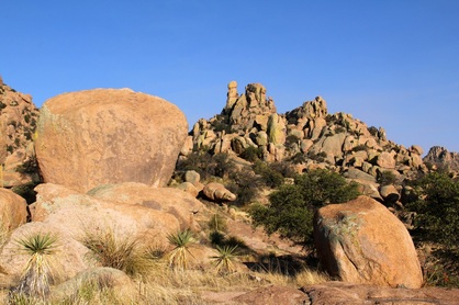
Council Rocks in the Cochise Stronghold
General O. O. Howard referred to Cochise as the 'most manly of all chiefs!' Cochise and Howard most likely met on the western slopes of the Dragoon Mountains at a place commonly known as 'Council Rocks.' This treaty was simple...promising that the government would supply food and clothing and setting aside the reservation that Cochise requested. It was also agreed that Thomas J. Jeffords would act as their agent. Cochise agreed to 'keep the road in that area open' and to refrain from all unlawful acts, in other words......'WAR!'
Cochise died in 1874. Two years later, in June of 1876, the government relocated Cochise's band to San Carlos per the Apache Concentration Policy.
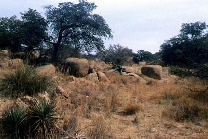
Peace treaty site, south of the mouth of the West Stronghold, 2000.
On October 10, 1872, Cochise and his Apaches held council to discuss Howard's proposal. " The meeting took place on 'a little nook some fifty yards up the mountain' just south of the mouth of Cochise's West Stronghold Canyon," Howard reported. Billy Fourr had his homestead a few miles away from the canyon and was shown the site by Tom Jeffords. Robert Forbes was taken there by Fourr and took a photo of the peace treaty site. (This original photo is shown on page 90 of 'Making Peace with Cochise --The 1872 Journal of Captain Joseph Alton Sladen;' Edited by Edwin R. Sweeney with the Foreword by Frank J. Sladen, Jr.; this photo is courtesy of the Arizona Historical Society, Tucson, AZ. AHS photo 5558.) The site remains untouched and is the same today and is exactly where described by Howard. Tom Jeffords referred to this as the 'Big Prayer Meeting on the Big Rocks,' when telling John Rockfellow about it. 'In front of it, probably a mile away, looking westward, was a large rocky knoll,' Howard wrote. Knob Hill or Treaty Peak (locally referred to as Treaty Hill), Jeffords and Salden were asked by Cochise to place a white flag on the peak. (Local story-line is that Cochise's son, Naiche, ran to the top of the hill and
placed the white flag to signify their agreement.)
Reference: 'Making Peace with Cochise -- The 1872 Journal of Captain Joseph Alton Sladen;' Edited by Edwin R. Sweeney with the Foreword by
Frank J. Sladen, Jr.
placed the white flag to signify their agreement.)
Reference: 'Making Peace with Cochise -- The 1872 Journal of Captain Joseph Alton Sladen;' Edited by Edwin R. Sweeney with the Foreword by
Frank J. Sladen, Jr.
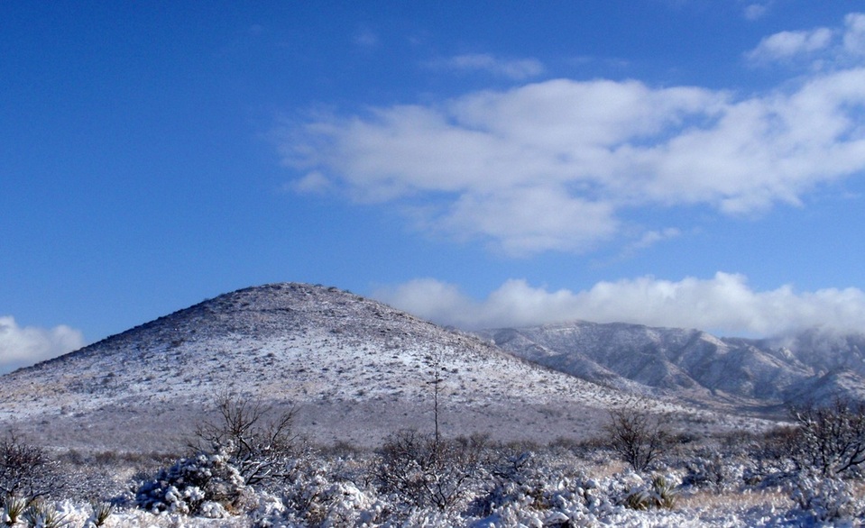
Today, Cochise Stronghold and Council Rocks, part of the Coronado National Forest in the beautiful Dragoon Mountains, is a great place to visit. Council Rocks has an elevation of over 4900' making for great summer temps and even a little snow in winter! Whether you just want to sit and relax, take in the sights and history, hike the hundreds of trails, rock climb or go camping, it's an easy destination with something for everyone!!
White House Ruins
* Horse Ranch
* Tweed's Ranch
* Horse Ranch
* Tweed's Ranch
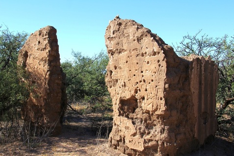
Adobe wall White House Ruins
White House Ruins in the Dragoon Mountains is just 3/10 mile past the 687 K turn off for Council Rocks on Forest Road 687 coming from Middle March Road. The Ruins are on private property, but some of the adobe walls are visible from the locked gate.
I have no research telling how it came to be known as the White House, but a coat of white wash seems like a simple answer. Horse Ranch and Tweed’s Ranch are two more names found on older maps. (Boss Tweed? No.) It seems to have been just that, a horse ranch, until the Apaches made life a little too exciting. The Apaches were relocated from the reservation in the Stronghold to the San Carlos Reservation in 1876 and that, as far as I can tell, was the last time the ranch was in use.
Access from Saint David over Horse Ranch Road is now blocked, so I’ve found coming in off Middle March Road to be the best route into the Stronghold.
See "Getting There " below for directions.
GETTING THERE:
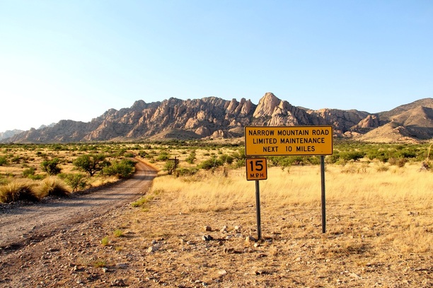
Forest road 687 at Middlemarch road
Take Middlemarch Road off Rt. 80 near Tombstone, (between mile markers 314 and 315). After 10.2 miles on Middlemarch turn left onto Forest Road 687. I've not seen a route sign for this road so here are the GPS coordinates. N 31 50.813 W 110 0.191
Follow Forest 687 for 6.7 miles and look for the post marker K 687. GPS N 31 54.630 W 110 02.351
It's a right turn, and after a short distance you're at the trail-head.

